Physical Address
304 North Cardinal St.
Dorchester Center, MA 02124

The Underline
Proposals for a linear park
Once characterised as being cut-off and difficult to access, the Isle of Dogs public transport network has been transformed over the years. In fact, the Zone 2 location is now one of the most accessible parts of London with multiple forms of public transport:
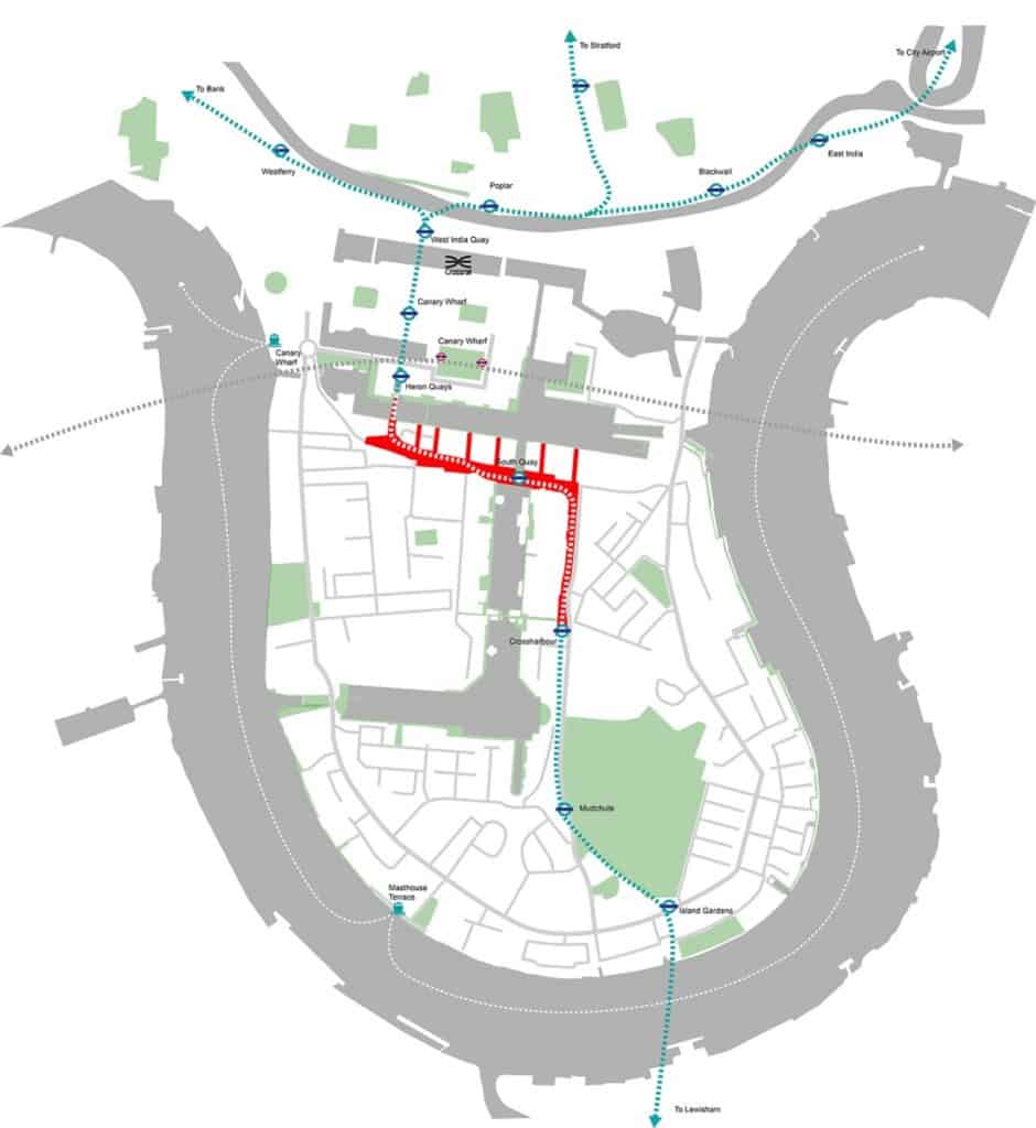
After multiple extensions, the DLR forms the backbone of the transport network. The southern fork of the route snakes from Bank in the City of London all the way through the Isle of Dogs as far south as Lewisham.
This has improved connectivity, but left a void of often under-utilised or derelict space beneath the elevated tracks. The Underline is a proposal to revitalise this space, and is a small idea that could have a big impact on the future of the Isle of Dogs development.


First proposed at the end of 2015, the Underline is an idea from landscape architects Spacehub Design.
The group have worked on multiple projects within Canary Wharf and the Isle of Dogs, designing landscaping for individual developments such as Dollar Bay, and Millharbour Village, as well as an extensive global portfolio.
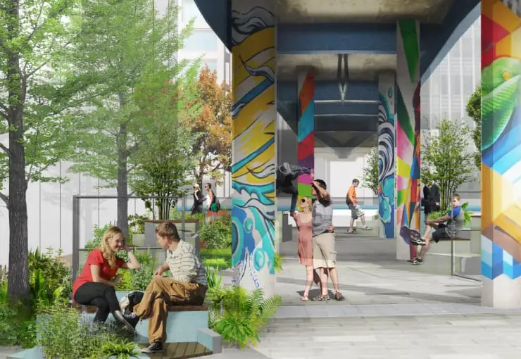
Experts in maximising spaces and bringing new greenery to urban areas, the Underline is a proposal to transform the underside of the elevated DLR tracks into a linear park.
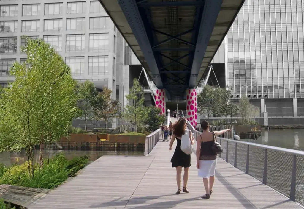
This would provide extra green space but also enable residents a sheltered walkway to transit between Canary Wharf to the Isle of Dogs.
The idea was conceived on a rainy site visit when we noticed locals were using the viaduct as a sheltered route to work, even though its alignment took them through a cluttered car park. That was when we saw the potential of creating a park under the viaduct.
Spacehub
Initially starting via individual developments, Spacehub’s idea is to create a 1 km long stretch of park running between Herons Quays DLR station on the Canary Wharf private estate, to Crossharbour DLR.
This takes advantage of the cover provided by the raised viaduct portion of the DLR, which transits into ground level and subterranean tracks further south of Crossharbour.
In addition, it would create a new footbridge link across Middle Dock and South Dock.

The Underline would transit areas of the highest density development on the Isle of Dogs, covering major developments and several thousand residents:
After successful implementation, this area could gradually be extended further North with the raised DLR tracks running through the Canary Wharf estate to Poplar. This has previously been identified as a key north south route that needs improving, and is set to be addressed with the upcoming North Quay development.
While a novel idea for E14 and the Isle of Dogs, similar ideas for maximising green space and creating linear parks within urban developments have proved successful.
While in 2021 — six years after the initial proposals from Spacehub — the Underline remains as a concept, there are signs that the project might take off. However, this is likely to be bite-sized pieces, rather than as one major construction project.
It looks like the Underline will begin with individual developments that border the elevated portions of the DLR tracks, each improving their section in turn:
In addition, there is a renewed focus on the Isle of Dogs for cohesive planning applications via the recently approved Isle of Dogs Neighbourhood Plan.
The underline ticks several of the Neighbourhood Plan’s boxes:
The upcoming construction of Quay House — with it’s approved plans looking to renovate the first patch of disused carpark that currently occupies the space of the Underline — will hopefully focus attention back to this idea.
One day, the Isle of Dogs might see its very own twist on New York’s Highline!
